 Catalogue de métadonnées
2011
Type of resources
Available actions
Topics
INSPIRE themes
Provided by
Years
Formats
Representation types
Update frequencies
status
Resolution
-
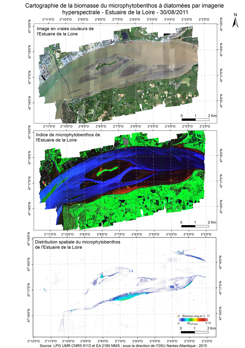
A new approach to mapping based on an optical model was developed and used from hyperspectral aerial images to determine the biofilm microphytobenthos and estimate their biomass in confined mudflats here in the Loire estuary in 2011.
-
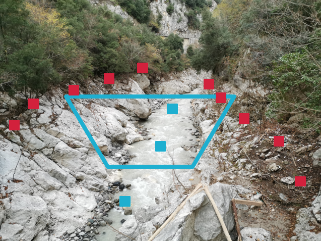
Dataset obtained from a post event field survey, after the september 2002 extraordinary flash flood event in the Gard region (France). The concerned watersheds are the Cèze, the Gardons, and the Vidourle. The post event survey aimed at gathering information about cross sections, peak discharges and flood dynamics. The dataset also includes stream gauge measurements, pictures and films, and interviews of witnesses. Cross section data was obtained from field measurements, generally with a theodolite sensor. Peak discharge data are indirect estimates based on local hydraulic analysis (Manning Strickler or other formulas), and are associated with estimated confidence intervals.
-
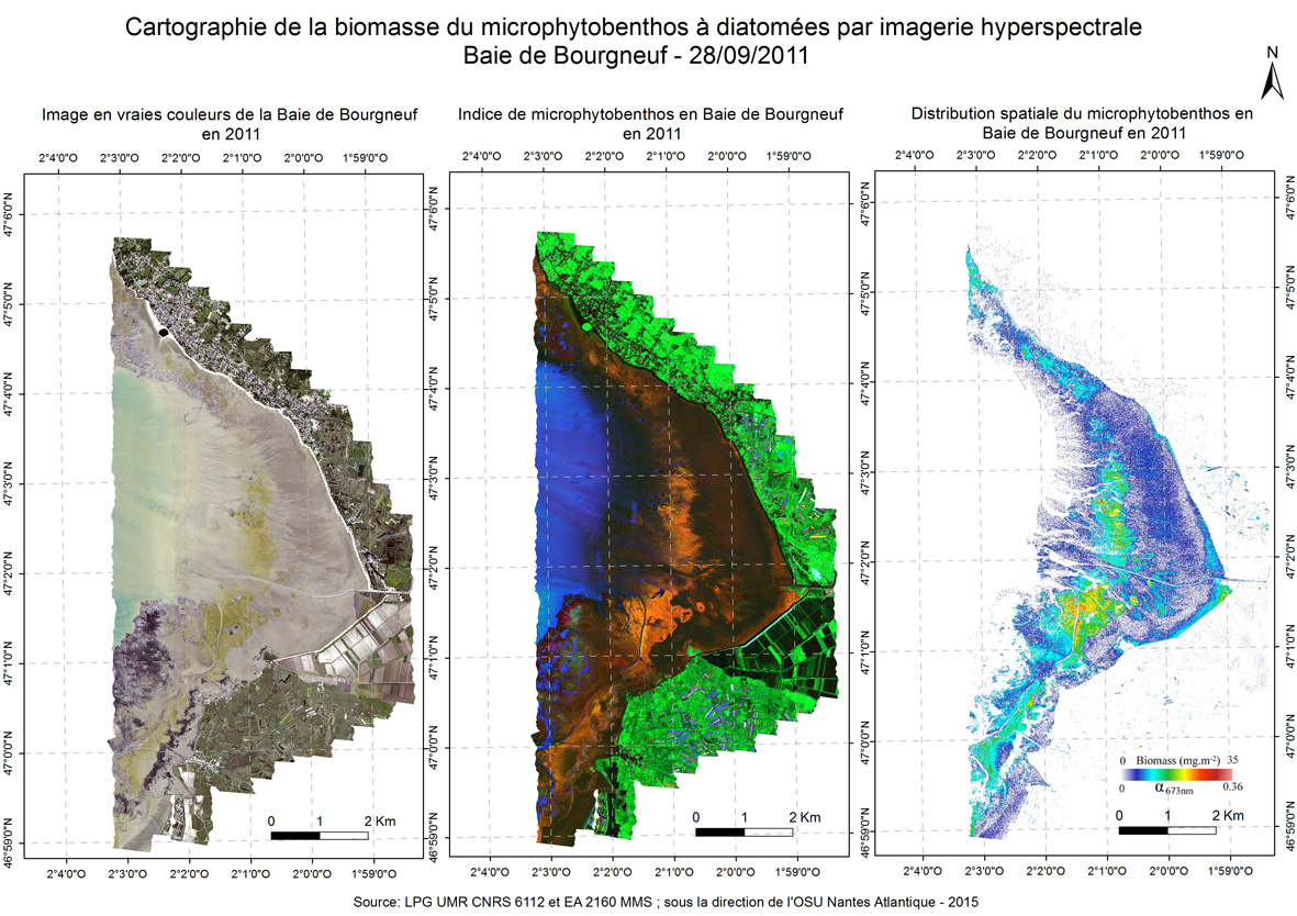
A new approach to mapping based on an optical model was developed and used from hyperspectral aerial images to determine the biofilm microphytobenthos and estimate their biomass in confined mudflats here in the Bay of Bourgneuf in 2011 september.